
Nova Totius Terrarum Orbis Geographica Ac Hydrographica Tabula
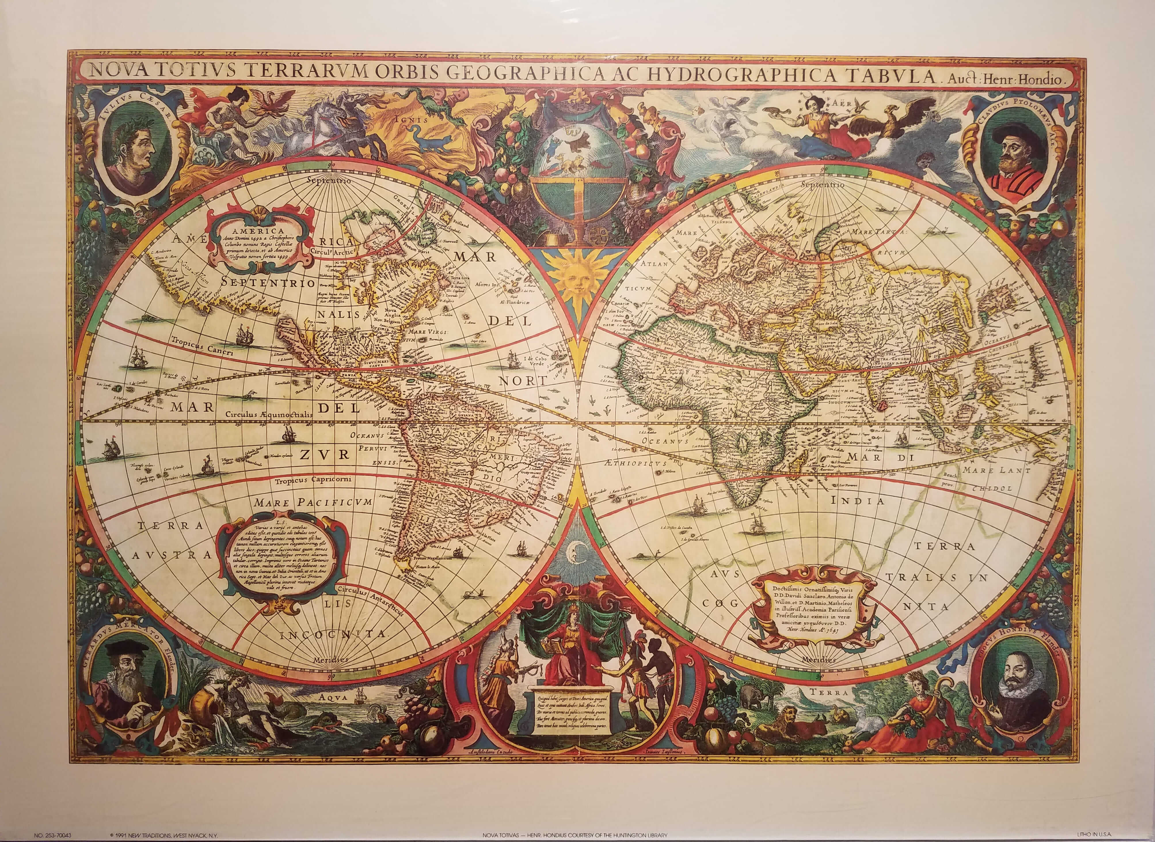
Mapping the World, One Adventure at a Time
Ever felt like you've stepped into a time machine when you've seen an old map? The intricate details, the faded ink, the sense of history that seems to seep from the parchment. Well, let's take a journey back to 1584, when the world was a much bigger mystery than it is today. Our destination? The Nova Totius Terrarum Orbis Geographica Ac Hydrographica Tabula, or as we'll call it for fun, the New Map of the Whole World.
Imagine this: You're in a grand library, the scent of old books and beeswax candles filling the air. You're surrounded by scholars, explorers, and royalty, all gathered around a table. On that table lies a map, not just any map, but one that's about to change the world. This, dear reader, is the scene that unfolded when Abraham Ortelius, a Flemish cartographer, unveiled his masterpiece.
Meet Ortelius, the Original Google Maps
Ortelius wasn't your average mapmaker. He was a globetrotter, a scholar, and a man with a vision. He spent his life collecting maps from explorers, traders, and other cartographers. Then, he did something extraordinary - he combined them all into one grand map. Think of him as the original Google Maps, but instead of satellites, he used ships and compasses.
Ortelius was also a bit of a rebel. He challenged the accepted wisdom of the time, the Ptolemaic model, which placed Jerusalem at the center of the world. Instead, he placed the Azores at the center, a group of Portuguese islands in the Atlantic. It was a bold move, and it showed the world that maps could be tools of exploration and discovery, not just religious symbols.
More Than Just Lines on a Page
The Nova Totius Terrarum Orbis was more than just a map. It was a work of art, a symbol of human curiosity, and a testament to the power of collaboration. It was the first modern atlas, containing 53 maps, each one a story of exploration and discovery. It was printed in Latin, Dutch, French, German, and Spanish, making it accessible to scholars and adventurers across Europe.

But here's where it gets really interesting. Ortelius didn't just draw lines on a page and call it a day. He added illustrations, coats of arms, and even a bit of humor. For instance, he included a picture of a sea monster in the Pacific, a nod to the mythical creatures that explorers often reported seeing. It's like he knew that maps weren't just about facts, they were about storytelling too.
Lessons from the Past, Tips for the Present
So, what can we learn from Ortelius and his masterpiece? Firstly, never stop exploring. The world is a big place, and there's always more to discover. Secondly, collaboration is key. Ortelius didn't create his map in isolation; he gathered information from people all over the world. Lastly, don't be afraid to challenge the status quo. Sometimes, the most exciting discoveries come from questioning what we think we know.

Now, you might be thinking, "That's all well and good, but I'm not a cartographer, and I don't have access to ancient maps." Here's the thing: you don't need to be a cartographer to be an explorer. Every time you step out of your door, you're exploring. Every time you try something new, you're discovering. And every time you share your experiences, you're creating a map for someone else to follow.
Reflections from the Present
As we zoom in and out of our digital maps, let's not forget the power of the physical ones. Let's not forget the stories they tell, the adventures they inspire, and the connections they forge. Let's not forget that every map is a testament to human curiosity, and every explorer, from Ortelius to you, is a hero in their own right.
So, go on, grab a map, any map. It could be a map of your city, your country, or the world. Look at it, really look at it. See the lines, the symbols, the stories. Then, step outside, and start writing your own.